"Doomsday Glacier" Melts From Below: Scientists Doubled Estimate of Its Contribution to Global Sea Level Rise
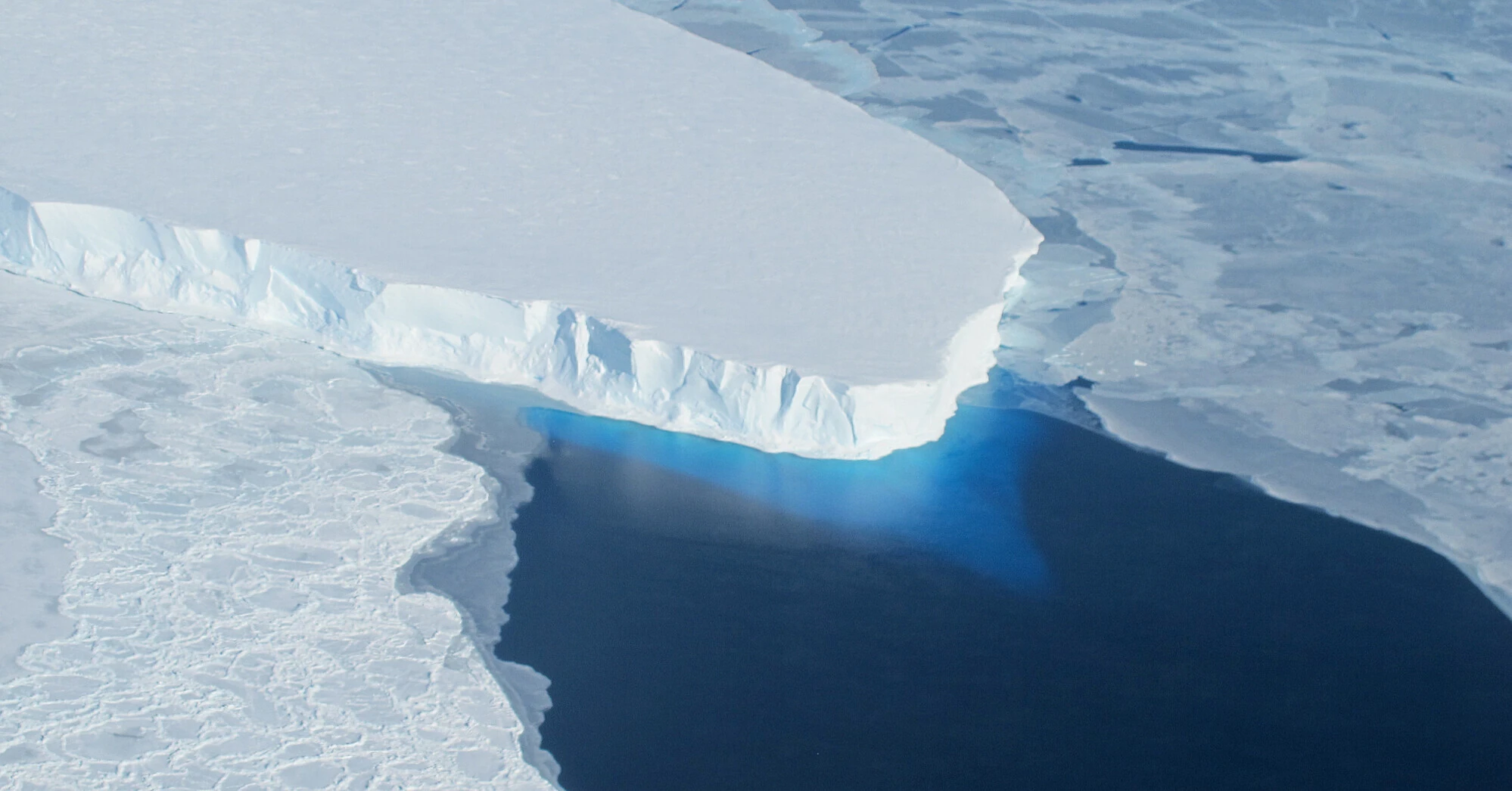
Under one of the most dangerous glaciers in Antarctica, a process is underway that computer models have long underestimated. Warm ocean water penetrates kilometers beneath the Thwaites Glacier, gradually destroying its connection to the seafloor. New research has shown: by 2100, this glacier could add up to 3 centimeters to average global sea level—about twice the previous average estimate. But the real danger of the "Doomsday Glacier" is not measured in centimeters: in the long term, its collapse could accelerate ice loss in West Antarctica, where we're talking about meters of ocean rise.
The study was published on October 12, 2026, in the scientific journal Nature Communications. It was prepared by specialists from the University of California, Irvine, NASA's Jet Propulsion Laboratory, and other research organizations.
Scientists have found that one of the main reasons for the glacier's retreat is hidden deep beneath its surface. And most unexpectedly—the new model shows significantly greater ice loss even without additional ocean warming.
Why scientists now talk about 30 millimeters instead of 15
Until now, international ice sheet models gave an average estimate of Thwaites' contribution to sea level rise by 2100 of about 15 millimeters under comparable climate conditions.
However, new calculations showed that the result strongly depends on how far seawater penetrates under the ice at its grounding line with the seafloor.
If this zone is relatively narrow, the predicted ice loss is less. But with a width of about five kilometers, the model gives a contribution to sea level rise of 30.1 millimeters with an uncertainty of about 5.7 millimeters.
That is almost twice the previous average estimate.
With a narrower transition zone, about three kilometers, the result is 19.4 millimeters with an uncertainty of about 5.2 millimeters. Thus, 30 millimeters is not a guaranteed forecast, but one possible outcome of the new model.
It's important to understand here: we are talking exclusively about the contribution of Thwaites Glacier. This is not a forecast of total ocean rise by the end of the century. Sea level is also affected by other glaciers, the Greenland and Antarctic ice sheets, and thermal expansion of ocean water.
What happens under the "Doomsday Glacier"
Thwaites is located in West Antarctica. Its area is comparable to the territory of Great Britain, and its width reaches about 120 kilometers.
It is a huge mass of ice that slowly moves from the continent toward the ocean. Part of the glacier rests on the sea floor, and nearer to open water the ice begins to float.
It is at the transition between these parts that a process occurs which has attracted the attention of researchers.
Previously, many computer models represented this boundary almost as a sharp line: on one side ice sits on the ground, on the other—it is already floating.
However, satellite observations have shown a different picture.
During tides, seawater can penetrate several kilometers under sections of the glacier that are usually considered grounded. The water temporarily lifts the ice and causes additional melting from below.
This forms a wide mobile zone where the contact between ice and seabed constantly changes.
This matters greatly for glacier stability. While it rests on underwater rises, they partially restrain its movement toward the ocean. As the contact weakens, the ice mass can retreat further and move faster.
In recent decades such changes have already been observed. From 1996 to 2023, the grounding line in the fastest-moving part of Thwaites retreated by about 25 kilometers.
When scientists included a wide zone of seawater intrusion into the new model, the calculations began to match real satellite observations of the retreat, thinning, and acceleration of the glacier much better.
Only after such validation did the researchers calculate its possible behavior until the end of the 21st century.
Why the year 2038 appeared in the study
Scientists are especially concerned about the Mouginot Ridge, a submarine ridge that currently helps hold back part of the Thwaites Glacier.
This seabed prominence is located at a depth of about 950 meters. While the ice keeps contact with it, the submarine topography partially prevents further retreat of the glacier.
But if ocean water continues to penetrate under the ice, this natural buttress may be lost.
In some scenarios of the new model, Thwaites loses contact with the ridge as early as 2038.
This is one of the most alarming details of the study, but it should not be interpreted as a date of glacier collapse.
2038 is the earliest result of individual calculations showing possible loss of contact with a specific submarine rise. It does not mean the total disappearance of the glacier or a sudden ocean rise in that year.
However, losing such support could change the further behavior of the ice mass. Behind submarine ridges lie deeper sections of the seafloor, where ice retreat under certain conditions can accelerate.
65 centimeters or 3.3 meters: why this glacier is considered so dangerous
The nickname "Doomsday Glacier" did not arise from this new study. It is linked to a much larger long-term threat.
According to an estimate by the British Antarctic Survey, complete disappearance of the Thwaites Glacier itself would correspond to an average global sea level rise of about 65 centimeters.
But potential consequences are not limited to that.
Thwaites plays an important role in the stability of the West Antarctic Ice Sheet. A large part of this huge mass of ice lies on bedrock that is below sea level.
If Thwaites' retreat contributes to accelerated movement of neighboring glaciers, ice loss could affect a much larger territory.
In a 2024 assessment published by the British Antarctic Survey, it was pointed out that complete melting of the West Antarctic Ice Sheet would correspond to a sea level rise of about 3.3 meters.
That exceeds the height of an ordinary doorway.
Such numbers imply a completely different scale of consequences for coastal cities, ports, and low-lying areas.
However, this is about possible changes over centuries and longer periods. The new Nature Communications study does not predict that all of Thwaites or West Antarctica will melt by 2100.
Estimates of 65 centimeters and 3.3 meters indicate the potential scale of long-term ice loss, not the expected result of the coming decades.
What will happen to coastal cities if the ocean rises by meters
To imagine possible consequences, it is enough to look at Miami—one of the well-known coastal cities in the United States.
Already today, certain areas of Miami Beach experience flooding during especially high tides. For street flooding, a hurricane or strong storm is not always required.
Sea level rise is gradually changing the operation of urban infrastructure. Water may penetrate drainage systems, raise the groundwater table, and hamper removal of stormwater.
The National Oceanic and Atmospheric Administration (NOAA) separately studies these processes in southeastern Florida. Experts warn that groundwater rise can affect building foundations, underground utilities, and other infrastructure.
Now imagine a much more distant scenario in which the average ocean level rises not by a few centimeters, but by several meters.
For low-lying coastal areas, this would mean a serious increase in the risk of permanent flooding. Roads, residential neighborhoods, utility networks, and water supply systems would have to be protected and rebuilt. In some places long-term habitation might become impossible without massive protective structures.
Some areas that are now near the shoreline could in time end up underwater.
Miami is far from the only city for which such processes matter. Similar long-term risks exist for low-lying areas of other large coastal cities and for island nations.
It cannot be asserted that a specific Miami neighborhood will be flooded specifically because of Thwaites by a certain year. Real consequences will depend on the combined sea level rise, vertical land motion, local topography, storms, and protective infrastructure.
Nevertheless, the example of Miami shows why scientists devote so much attention to processes occurring thousands of kilometers away from populated coasts.
Why ice loss is possible even without additional ocean warming
Another surprising feature of the study lies in the conditions used for the calculations.
The authors modeled the glacier's behavior under a constant climate forcing based on average conditions of 1996–2023.
In other words, the main calculations did not assume further increases in ocean temperature beyond these conditions.
However, even with such an assumption the model showed significant ice loss.
This means that not only future warming plays an important role, but also already existing conditions in which seawater penetrates beneath the glacier and weakens its contact with the seafloor.
At the same time, the study does not prove that further warming no longer matters. Changes in ocean temperature and circulation can additionally affect melting rates.
Other uncertainties remain: the exact width of the water intrusion zone, the nature of subglacial currents, and the peculiarities of the ice mass' interaction with the seabed.
Therefore, scientists continue to use satellites, geophysical surveys, and direct measurements under the ice to refine their models.
The real danger is not a giant wave, but a slow change of the world map
Thwaites Glacier is dangerous not because it will one day break off and cause a giant wave that crashes onto distant shores. That is a common but mistaken notion about the consequences of glacier melting.
The real threat is much slower—and therefore in a certain sense harder.
Huge masses of ice that are now on land gradually pass into the ocean. Water accumulates, raising the average sea level. This process continues for years, decades, and centuries, gradually changing living conditions on coastlines.
Today scientists are refining the estimate of Thwaites' contribution by 2100 to just a few centimeters. But behind these numbers lies a more serious question: will the glacier keep its natural supports, or will its retreat become part of a long-term loss of stability of the West Antarctic Ice Sheet?
The answer determines how quickly future generations will have to rebuild coastal cities, reinforce shorelines, protect utility networks, and perhaps abandon life in certain low-lying areas.
The new study does not set a date of global catastrophe. It shows that one of the processes that can accelerate Antarctic ice loss could be significantly more important than previous models assumed.
That is why the fate of a remote glacier in Antarctica concerns not only polar researchers. Over time it can affect where the planet's coastlines will run and which territories remain livable.
Based on materials from: Nature Communications—original study from October 12, 2026, University of California, Irvine and NASA JPL—report on the study, British Antarctic Survey—assessment of long-term consequences of glacier collapse, NOAA—influence of sea level rise on infrastructure in southeastern Florida.